Rapid Land Audit - Livingstone City
- Jedidiah Chibinga
- Dec 15, 2025
- 2 min read

Location: Livingstone, Zambia | Organisation: Development Workshop Zambia | Full Report
In support of the Zambian government's New Land Policy and the Livingstone City Council (LCC) in improving land administration and management, I served as a GIS analyst for a Rapid Land Audit. The project aimed to bridge the information gap caused by the slow pace of national land audits. Our team delivered a comprehensive assessment of urban growth, land use, and informal settlement expansion over 10 years (2014–2023).
Technical Approach
To track urbanisation and determine the growth of informal settlements, we utilised a mixed-method approach:
Remote Sensing & Change Detection: We acquired and georeferenced high-resolution Google Earth imagery for 2014 and 2023. Using GIS, we digitised rooftops to quantify housing growth and visualise urban expansion trends over the decade.
Field Verification: We conducted in-situ field visits to 13 settlements (including Mwandi, Nakatindi, and Ngwenya) to ground-truth spatial data, confirm settlement boundaries, and assess the availability of services like water and electricity.
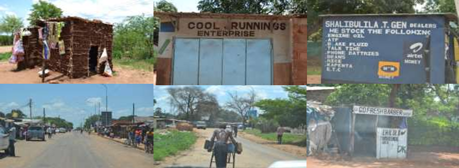
Common informal economic activities in the informal settlements (source). GIS Data Integration: We converted land use data from the 2021 Integrated Development Plan (IDP) into shapefiles to analyse discrepancies between planned zoning and actual land utilisation.
Spatial Analysis
A. Land Use Allocation
The first phase involved acquiring and establishing town boundaries and the planned formal land use allocation by the local authorities in the Integrated Development Plan (IDP).

According to the derived map, 49% of the district is planned for agricultural land use, and 11% for urban land use, with residential accounting for most of the urban district.
B. Urban Expansion (2014–2023)
Using temporal satellite analysis, we visualised the city's physical growth footprint.[INSERT

We identified that most growth occurred along major road corridors (Lusaka and Nakatindi roads) and within low-cost housing areas.
C. Informal Settlement Growth
A critical component of the audit was tracking the proliferation of unplanned settlements. Our data revealed a 42% increase in informal dwellings, from 10,783 in 2014 to 15,356 in 2023.

Specific settlements like Sakubita saw dwellings increase from 916 to 2,748, highlighting an urgent need for upgrading and formalisation.

Key Findings
The audit provided the Livingstone City Council with actionable data to address the housing backlog and infrastructure deficits:
Identification of Opportunity Sites: We mapped 33.7km² of unoccupied/open urban space suitable for infill development, allowing the Council to plan for service delivery rather than expansion into greenfields.
Infrastructure Planning: The study highlighted that the "sale of unserviced plots" was a major driver of informality. Our findings support the "Housing for All" programme, advocating for a "site, plan, and service" model before allocation.
Policy Recommendations: The report recommended integrating GIS processes directly into Council operations to improve data ownership and planned upgrading of 5 unplanned settlements (Simonga, Sinde, Manjeleti, Mulala, and Sakubita).
Related Resources:
Full Report: Livingstone-Land-Audit-DWN-Zambia-May-2024